
Zhu Mei
China has the longest land border in the world totaling more than 22,000 kilometers. Many of the border towns are diverse and share both Chinese and foreign characteristics. CGTN has collected 10 beautiful border cities and towns in China for tourists.
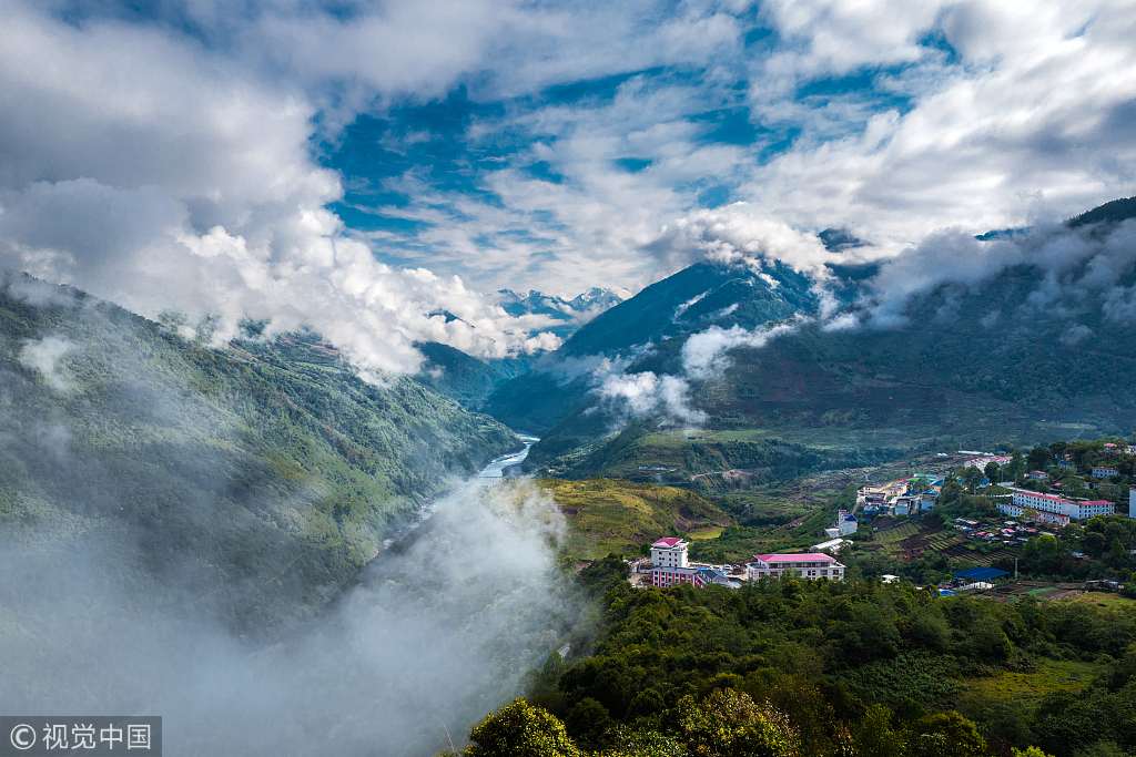
Wrapping up our last trip in Xinjiang Uygur Autonomous Region, let’s move further south and kick off an adventure journey in southwest China’s Tibet Autonomous Region. Metok or Medog is a border county of the Nyingchi Prefecture in southeast Tibet, sitting close to India. Due to its complex geographic and weather condition, Metok County is a paradise for adventure seekers.
Tourists would be amazed by the ecological environment in Metok County as it ranks first among all counties in China in terms of forest coverage, with a forest coverage rate of over 79.2 percent. Metok also boasts as many as 500 waterfalls with the famous ones include the U-shaped Waterfall, the Hanmi Waterfall and the Tiger`s Mouth Waterfall. The following are some recommended tourist spots and travel routes.
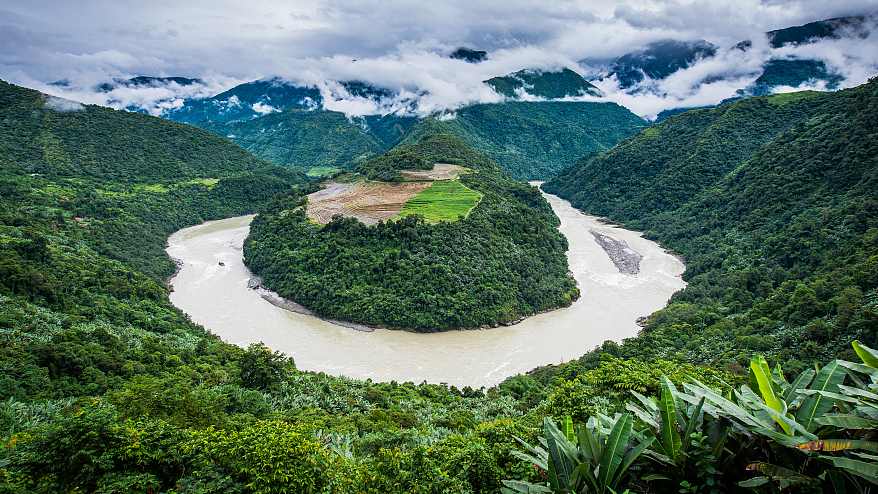
An aerial view of the Metok County in Nyingchi Prefecture, southwest China’s Tibet Autonomous Region. /VCG Photo
Yarlung Tsangpo Grand Canyon
Yarlung Tsangpo Grand Canyon is the largest and deepest canyon in the world, 504.6 kilometers long and 6,009 meters deep at its deepest. The world highest river Yarlung Tsangpo River runs through a narrow passage between the two 7,000-meter high peaks of Namjagbarwa and Jialabailei, forming the canyon, located ninety percent in Metok County.
The canyon is regarded as “the Gene Pool of Biological Resources” as it is home to many living species. There are more than 3,500 species of plants and nearly 5,000 species of vegetation have already been found here.
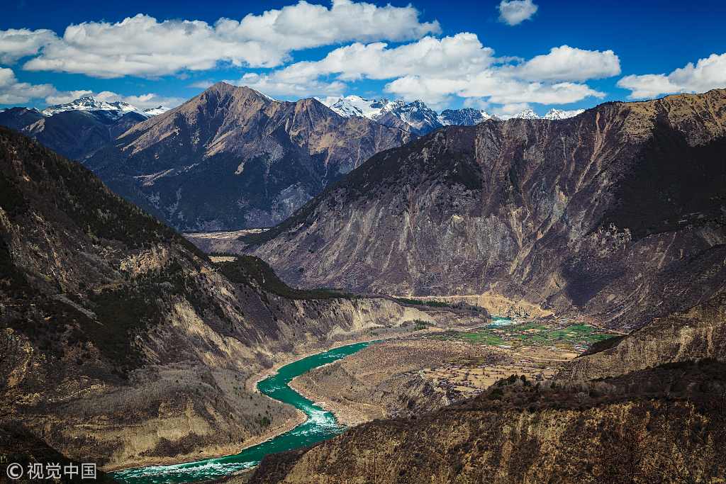
Yarlung Tsangpo Grand Canyon in southwest China’s Tibet Autonomous Region. /VCG Photo
Mount Namjagbarwa
Regarded as “the father of glaciers”, Mount Namjagbarwa was named the top of the ten most beautiful mountains in China by Chinese National Geography in 2005. It is the highest peak in the eastern part of the Himalayas, with an altitude of 7782 meters.
Mount Namjagbarwa is also known as the “shy girl mountain” as its huge triangular peak covered by snow and clouds all year round never shows its true face. Mount Namjagbarwa stretches across the tropical and boreal regions, thus, it is also a “museum of natural history.”
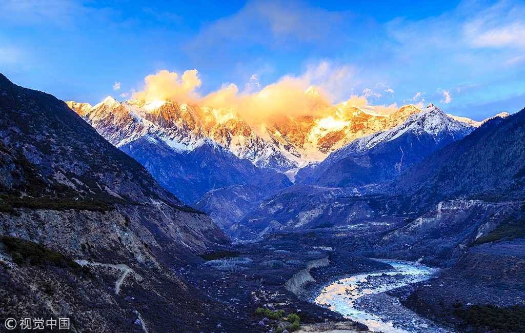
Mount Namjagbarwa in southwest China’s Tibet Autonomous Region. /VCG Photo
China’s last county without a highway
Metok County is China’s last county with no highway link. Local people used to deliver supplies only by manpower. The terrible weather conditions like snow and rainstorm have made the construction of mountain roads extremely difficult.
In 1993, the Bome-Metok Highway was discarded only three days after its opening to the public because of a severe rainstorm. The renovation project commenced at the pass of the Galongla Snow Mountain in 2009. Finally, on October 31, 2013, the renovated highway was open to traffic officially, marking the end of Metok’s history without a permanent highway.
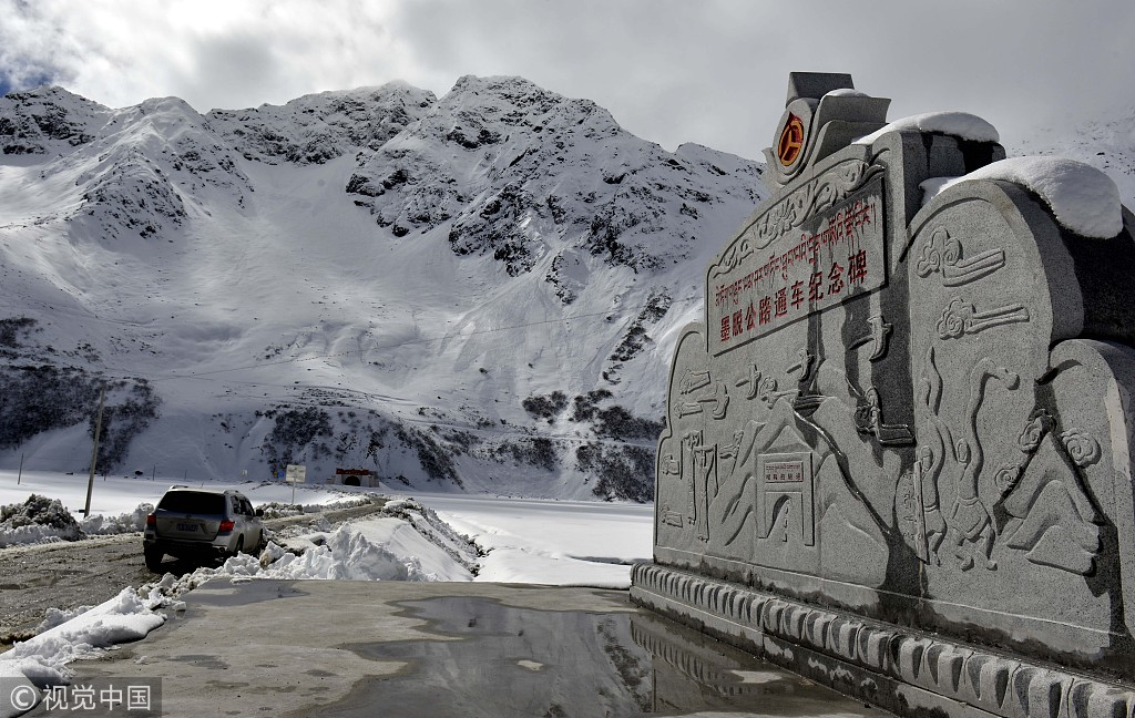
The monument of the Bome-Metok Highway in southwest China’s Tibet Autonomous Region. /VCG Photo
Trekking in Metok
The trekking route from Pai Village to Metok County is 78 kilometers, known as the No.1 challenging trekking route in China and is also the most attractive one. It usually takes three days to complete the whole path and trekkers need to climb across the Doxong La Snow Mountain with an altitude of 4200 meters. Trekkers are highly recommended to hire a professional guide to lead the adventure route.

Source: https://news.cgtn.com/news/3d3d674e31557a4e33457a6333566d54/i